Explainer 2:

The Strategic Importance of the Philippines
A map exercise to familiarize students with the location of the Philippines and its strategic importance to the United States and Japan.
Teacher Background
The Philippines is an archipelago of more than 7,000 islands in the Pacific Ocean off the southeast coast of China; in 1898, when the U.S. annexed the Philippines after the Spanish-American War, the islands were home to 7,600,00 people who spoke more than a dozen languages and practiced many religions. President William McKinley justified the U.S. acquisition of the Philippines because, he claimed, the U.S. had a duty to Christianize the Filipinos and to teach them the principles of self-government. This rationale ignored the fact that many Filipinos were Catholic, that there were established middle and elite classes, and that, by 1898, Filipinos nationalists wanted to establish a republican government. The U.S., like other Western powers, saw itself as a beneficial “civilizing” influence.
But it was really about the Philippines’ strategic location and opportunities for trade. In a speech to Congress in 1900, Senator Albert J. Beveridge noted, “This island empire is the last land left in all the oceans… Our largest trade henceforth must be with Asia. The Pacific is our ocean. More and more Europe will manufacture the most it needs, secure from its colonies the most it consumes. Where shall we turn for consumers of our surplus? Geography answers the question. China is our natural customer. She is nearer to us than to England, Germany, or Russia, the commercial powers of the present and the future. They have moved nearer to China by securing permanent bases on her borders. The Philippines give us a base at the door of all the East.”
In addition to opening the door to the China market and being a place where U.S. manufacturers could sell goods, the Philippines were also an important site of production for raw materials, especially sugar, that could be shipped back to the American market. And, as in its other Pacific territories, the U.S. also established military and naval bases in the islands, to protect its interests and expand its sphere of influence. Eventually, these naval bases and the Philippines’ strategic location would make the islands a target when Japan sought to extend its own empire in the 1930s. Indeed, at the same time as the Pearl Harbor attack, the Japanese bombed U.S. naval installations in the Philippines.
Suggested Teaching Strategies
-
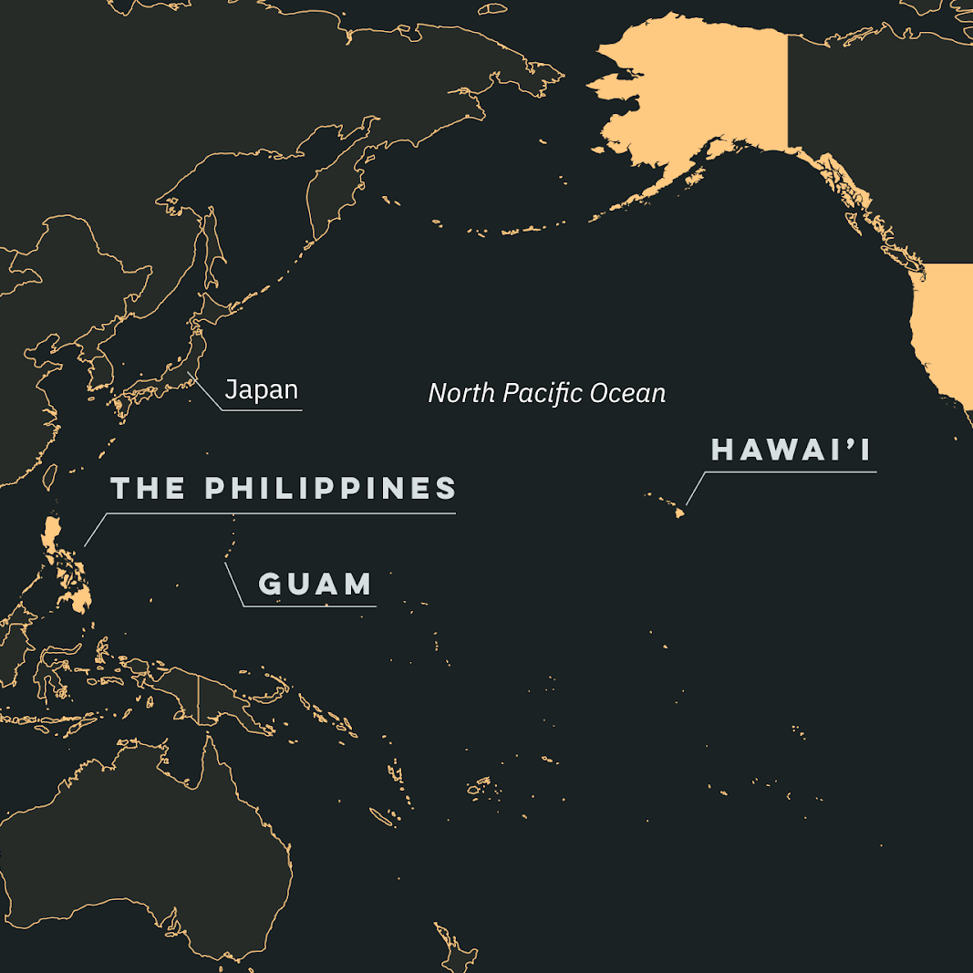
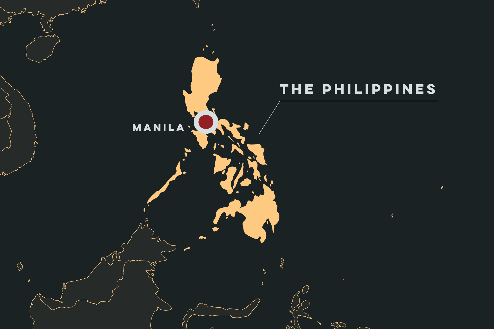
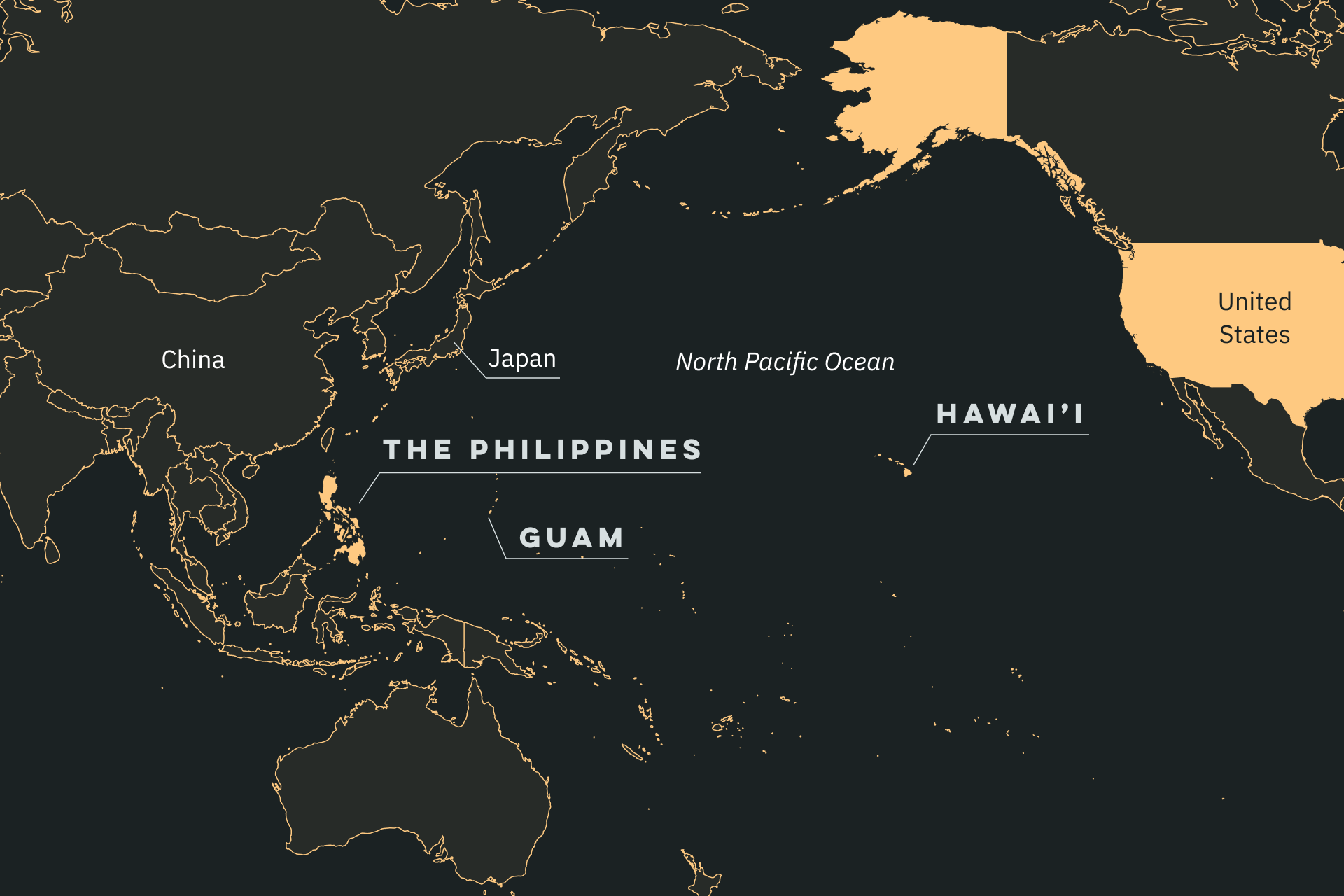
Ask students to find the Philippines on a map or use the map provided to note its relative position to the United States and to various countries in Asia.
-
Note with students that the Philippines are an archipelago, a collection of more than 7,000 islands and that Filipinos are incredibly diverse, speaking more than a dozen languages and practicing many religions as you move around the islands.
-
In their textbooks, in the Under One Flag exhibition or drawing on prior knowledge, ask students to find examples of how U.S. leaders justified the annexation of the Philippines.
-
Read the Beveridge quote and examine the map below, then ask students to reflect on connections between the Philippines’ location and the reasons why the United States wanted to colonize them. Ask students to speculate on the challenges the Philippines’ geography would present to the U.S., the Japanese, or other colonial powers in taking control or defending their territories.
Curriculum Standards
Common Core: Middle School
- CCSS.ELA-LITERACY.RH.6-8.7 Integrate visual information (e.g., in charts, graphs, photographs, videos, or maps) with other information in print and digital texts.
Common Core: High School
- CCSS.ELA-LITERACY.RH.11-12.9 Integrate information from diverse sources, both primary and secondary, into a coherent understanding of an idea or event, noting discrepancies among sources.
The Strategic Importance of the Philippines
The Philippines is an archipelago of more than 7,000 islands in the Pacific Ocean off the southeast coast of China; in 1898, when the U.S. annexed the Philippines after the Spanish-American War, the islands were home to at least 7,600,000 people who spoke more than a dozen languages and practiced many religions.
“This island empire is the last land left in all the oceans… Our largest trade henceforth must be with Asia. The Pacific is our ocean. More and more Europe will manufacture the most it needs, secure from its colonies the most it consumes. Where shall we turn for consumers of our surplus? Geography answers the question. China is our natural customer. She is nearer to us than to England, Germany, or Russia, the commercial powers of the present and the future. They have moved nearer to China by securing permanent bases on her borders. The Philippines give us a base at the door of all the East.”
–Senator Alvin J. Beveridge, Speech to Congress, 1900
Focus Questions
-
Locate the Philippines on a map. What inferences can you draw about the reasons why the U.S. wanted to annex them as a colony, based on its location?
-
What challenges would an imperial power have in asserting its control based on the Philippines’ geography?
-
What reasons did the U.S. use to justify its acquisition of the Philippines? What role did geography play?
-
What U.S. overseas territories “connected” the Philippines to the U.S. mainland? How and when did the U.S. acquire these Pacific territories?
To learn more, see “Chapter One: The Colonial Period” in the online exhibit Under One Flag.
